
Project Overview
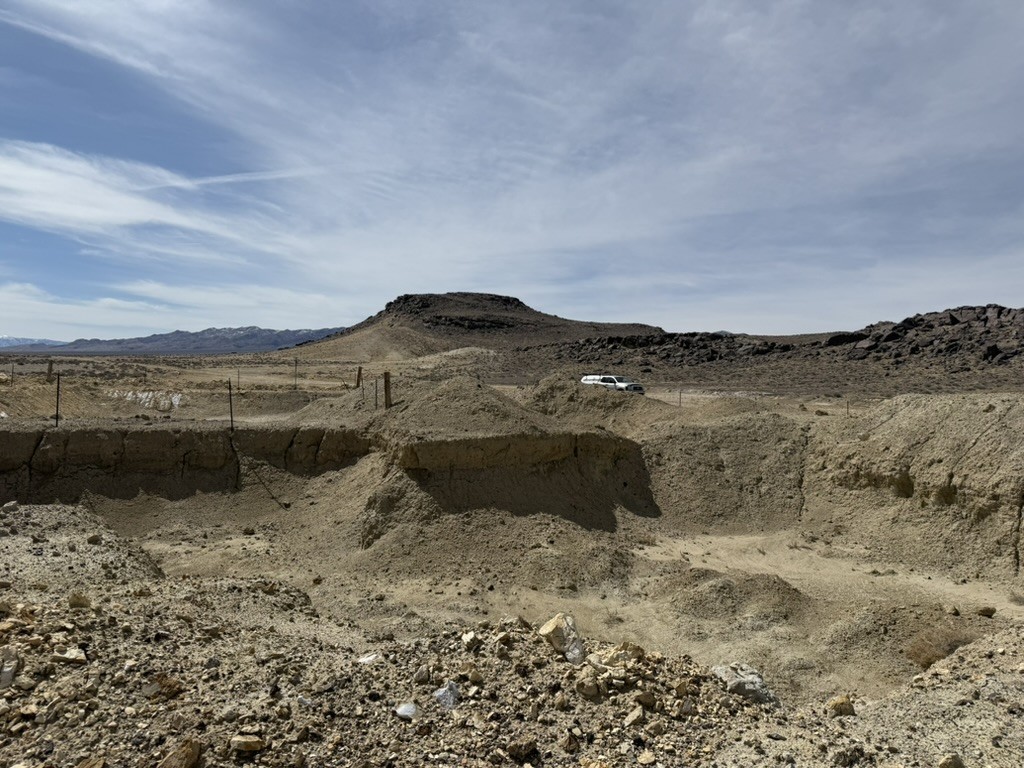
The Weepah Hills geothermal project, located in Esmeralda County, west-central Nevada, is one of the most data-rich unexploited geothermal prospects in the western United States. It sits within the Walker Lane structural belt — Nevada’s most productive tectonic corridor for geothermal energy — in a geological setting that concentrates heat far above the regional average.
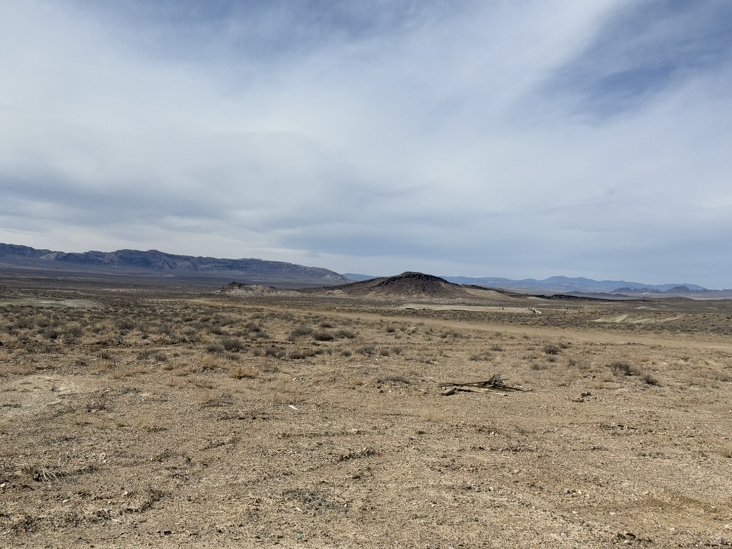
What makes Weepah Hills distinctive is its nature as a blind geothermal system: there is no steam, hot springs, or surface thermal activity to signal what lies beneath. The heat is concealed under alluvial cover, discovered not by chance but by systematic exploration. That is precisely what makes it compelling — decades of rigorous data collection have built a compelling subsurface picture without ever requiring a hot spring.
A Unique Play Type
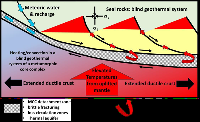
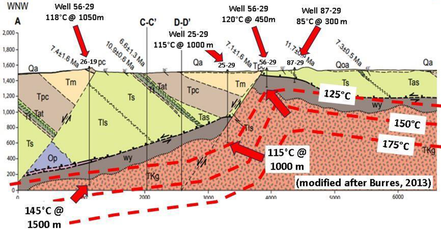
The geothermal system at Weepah Hills is associated with the Silver Peak–Lone Mountain metamorphic core complex, a mid-Miocene geological feature formed by crustal stretching and thinning. Metamorphic core complexes elevate the regional geothermal gradient dramatically — at Weepah Hills, measured gradients exceed 440°C per kilometer, compared to the US average of around 30°C/km. The combination of an active heat source, a fault-controlled fluid system, and an impermeable cap structure creates the architecture of a productive geothermal reservoir.
This play type is recognized by the geothermal industry as a category of high-potential blind systems — systems where the resource quality cannot be judged from the surface, but where the subsurface data speak clearly.
Fifty Years of Exploration Data
Regional thermal-gradient drilling began at Weepah Hills in the late 1970s and has continued across multiple owners and operators ever since. The result is an exploration dataset that is rare for any undeveloped geothermal prospect:
- More than 50 shallow thermal-gradient boreholes drilled across the project area
- Gradients consistently above 75°C/km, with a peak observation of 440°C/km
- Direct fluid evidence: one borehole encountered boiling water at 239 meters depth
- Chemical analysis of geothermal fluids indicates reservoir temperatures of 150–230°C — well within the commercial range for binary-cycle power generation
- Independent resource assessments estimate geothermal capacity of 30 megawatts or more — sufficient for a commercial baseload power plant
No other significant geothermal prospect in the Walker Lane carries this volume of pre-competitive data without a producing plant already on it.
2025 Magnetotelluric Survey
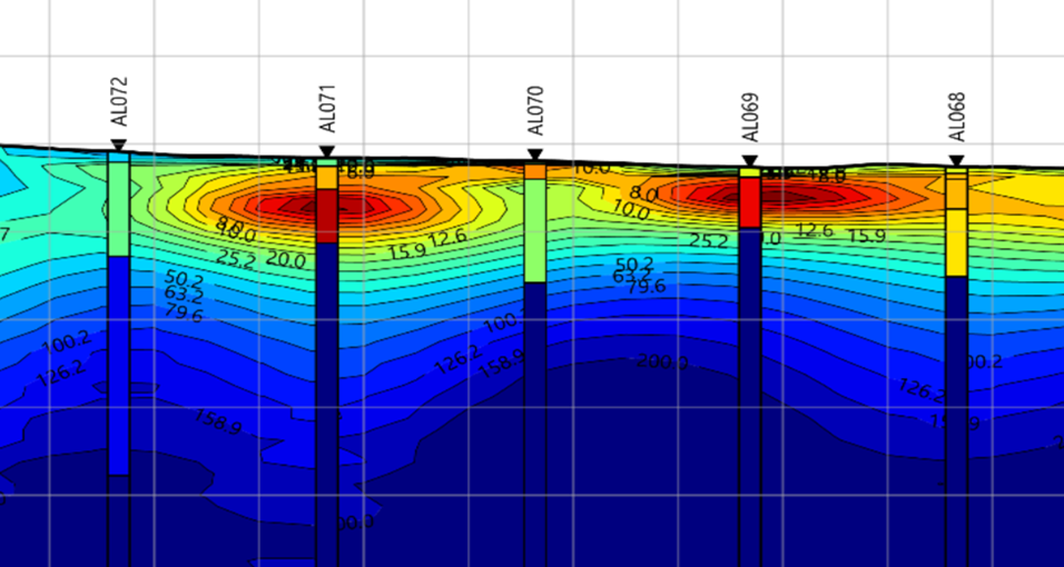
In early 2025, Ignis commissioned an 88-station magnetotelluric (MT) geophysical survey across the project area — the first new geophysical dataset acquired here in over a decade. MT measures the subsurface electrical resistivity structure to depths of several kilometers, imaging fluid pathways, alteration zones, and structural features that thermal-gradient wells cannot reach.
The 2025 survey was interpreted with key results:
- Two distinct clay cap anomalies identified — hallmarks of a sealed geothermal reservoir where heated fluids have altered the cap rock
- A gravity-correlated anomalous zone in the south of the lease area, consistent with a deep fault or fracture system that could act as a fluid conduit
- Overall data quality rated very good to excellent
The 2025 MT survey is the most recent and spatially comprehensive geophysical dataset for the Weepah Hills–Alum system. It confirms the subsurface architecture expected above a productive geothermal reservoir and identifies priority targets for the upcoming drilling program.
Transmission & Infrastructure
Geothermal development depends not just on the resource — it depends on being able to deliver power to market. Weepah Hills is exceptionally well-positioned:
NV Energy Greenlink West (525kV): Nevada’s new transmission superhighway, approved by the Nevada Public Utilities Commission in September 2024, routes through Esmeralda County directly adjacent to the project area. Greenlink West was designed specifically to carry renewable energy from Nevada’s resource-rich counties to load centers in Nevada and California.
Existing grid connections: The Silver Peak electrical substation — located just 5 kilometers from the project — provides an operational connection between the Nevada and California power grids. Additional transmission infrastructure crosses or adjoins the project lease, including a 125kV line and the BPA direct-current trunkline.
The combination of a new 525kV corridor purpose-built for renewables and multiple existing pathways gives Weepah Hills an infrastructure position that most greenfield geothermal projects in Nevada cannot match.
Development Status
Ignis acquired the Weepah Hills lease in October 2024 and has since advanced the project on multiple fronts:
- Geological modeling: A full 3D geological model of the Weepah Hills subsurface has been constructed and updated using all available historical and new data
- Environmental surveys: Biological surveys required by the Bureau of Land Management have been completed. The project area is clear
- Permitting: Advanced discussions with the BLM Battle Mountain District are underway under the Categorical Exclusion (CX) pathway — the expedited permitting route for low-disturbance exploration drilling
- Rig contracting: Active engagement with multiple drilling contractors for the temperature-gradient well (TGW) program
Next milestone: Temperature-gradient well drilling, targeting mobilization July 2026. The TGW program will acquire new temperature and fluid data directly from the Ignis lease, confirm resource characteristics, and define locations for follow-on confirmation wells.
Offtake Agreement — Clean Energy Alliance
Weepah Hills has secured a geothermal offtake arrangement with Clean Energy Alliance (CEA), a California Joint Powers Authority that serves over 380,000 residential and commercial accounts across San Diego County.
Under the agreement framework, Ignis will deliver 30 megawatts of baseload geothermal power from the Weepah Hills project to CEA for a 20-year term, delivered to the CAISO grid at Coaldale Substation in Esmeralda County. The product qualifies as Portfolio Content Category 1 — the highest classification under California’s Renewables Portfolio Standard, providing both energy and renewable energy certificates.
The CEA arrangement is a significant commercial milestone. It demonstrates that a creditworthy California utility buyer has independently assessed the Weepah Hills resource, accepted the geothermal play type, and committed to a long-term offtake relationship — before a single Ignis well is drilled. That is a measure of institutional confidence in both the resource and the Ignis team’s ability to develop it.
About Esmeralda County, Nevada
Esmeralda County is geologically one of the most active geothermal counties in the United States. It hosts Albemarle Corporation’s Silver Peak lithium operation — the only producing lithium mine in North America — and sits at the intersection of the Walker Lane and Basin and Range tectonic provinces. The county has no environmental restrictions on geothermal development, a cooperative BLM district, and a long history of mineral and energy extraction. For Ignis, it is a strategic address in the US geothermal development landscape.