
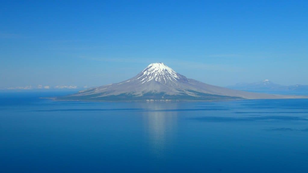
From two field seasons to a DOE selection: how Ignis built the case for Mount Augustine
Selected by the U.S. Department of Energy for award negotiations, Alaska’s Mount Augustine geothermal project is heading toward its first confirmation well. ThinkGeoEnergy spoke with the Ignis Energy team about how the project got here, and where it goes next.
On September 21, the U.S. Department of Energy announced 21 projects selected under its next-generation geothermal funding opportunity, DE-FOA-0003472, with more than $99 million set aside for the program. Sixteen of them are exploration and confirmation drilling projects. One is in Alaska: GeoAlaska LLC’s program to drill, core, log and test a confirmation well on the southern flank of Mount Augustine, a volcanic island in lower Cook Inlet.
For Ignis Energy, a long term team member and investor in GeoAlaska, the selection is the latest step in a project the team has been working on since 2023. Award negotiations with DOE are now starting.
A grid running out of gas
The case for Augustine starts with Southcentral Alaska’s power supply. The Railbelt grid serves roughly three quarters of the state’s population, from Anchorage and the Kenai Peninsula to Fairbanks, and Cook Inlet natural gas has long carried most of its generation. Cook Inlet production once ran above 200 billion cubic feet a year. It is now below 100.
Hilcorp Alaska, the basin’s main producer, has told Chugach Electric Association that it will not extend gas supply contracts beyond March 31, 2028. Chugach is planning to import LNG as a bridge while alternatives are developed.
The Ignis team sees Augustine as one of those alternatives. The island sits about 280 kilometers southwest of Anchorage. It is an active andesitic stratovolcano that last erupted in 2006, and the Alaska Volcano Observatory has monitored it for decades. The heat is not in question. What the team set out to find was a way to reach it.
Two field seasons
The team designed and ran two exploration campaigns on the southern flank.
The 2023 season combined a gravity survey of more than 200 stations with 28 audio-magnetotelluric stations. In 2024 they came back with a 40-station broadband magnetotelluric survey, deep enough to bring the volcano’s heat source into the model, followed by a 3D joint inversion of the magnetotelluric and gravity data and a Monte Carlo resource assessment.
The two methods, one measuring density and the other electrical resistivity, pointed to the same structure: a clay-rich cap sealing a hotter zone beneath it, above a magma storage zone that seismic monitoring had already located independently.
The team tied its model to independent data. Published U.S. Geological Survey seismic tomography (Koulakov et al., 2023) shows velocity ratios beneath the cap consistent with water and possibly steam at depth. Laboratory analysis of rock samples from outcrops on the island confirmed the smectite clay that the geophysics had pointed to as the cap.
All of this was privately funded. No federal, state or utility money went into the exploration.
Published and reviewed
The team published the results in GRC Transactions (Oliver et al., 2024, Vol. 48, “Mount Augustine: Exploring for a New Geothermal Resource in Southcentral Alaska”) and presented them at the Geothermal Rising annual meeting in Hawaii. The paper put the southern flank’s median (P50) resource at 224 MWe.
That work builds on independent research and decades of academic and U.S. Geological Survey study of Augustine’s volcanic system. Ignis has since presented the program at industry and investor forums.
“We have done everything that can be done from the surface to document this resource and put it through peer review,” said Marcus Oesterberg of Ignis Energy. “The one step left before development plans are drawn up is a confirmation well. That well will show us how to drill this resource and what its full potential is.”
From science to support
Outside interest followed the science. In May 2026, Alaska Governor Mike Dunleavy and POSCO International signed a memorandum of understanding covering six Alaska development projects. The Mount Augustine Geothermal Energy Project and the Mount Augustine Green Methanol Project are the first two on the list.
The project has also drawn strong interest from several offtakers, including data centers and Chugach Electric Association, Alaska’s largest electric utility.
Then came the DOE selection, the only Alaska project among the 21.
What comes next
The next milestone is Kamishak #1, a confirmation well on the southern flank. In DOE’s own description, it will characterize the reservoir with a shallower target above 150°C and a deeper target above 350°C. It is a data well, not a production well. Its purpose is to measure permeability, temperature and fluid chemistry directly, the questions no surface survey can settle.
Well planning, permitting and coordination are already under way. The team says that work was moving before the selection and would have continued without it. Award negotiations with DOE now set the terms of the federal share, and a selection opens those negotiations rather than guaranteeing an award.
The data will not stay private. Under the program’s award, results go to DOE’s Geothermal Data Repository, where anyone working on volcanic geothermal systems can use them.
“We are an exploration-first developer. We drill to learn before we drill to commit,” Oesterberg said. “Kamishak #1 is that well. What it teaches us about drilling into a stratovolcano will be useful well beyond Augustine.”
For the Railbelt, the question is whether a volcano 280 kilometers from Anchorage can become firm, fuel-free baseload before the gas contracts run out. For the Ignis team, Kamishak #1 is how they intend to find out.
